South Haven
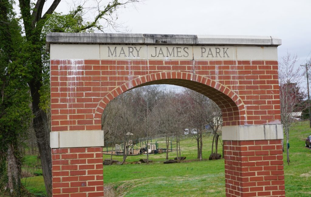
Mary James Park, at the intersection of South Haven Road and McClung Avenue, is one of the most prominent landmarks which speaks to the history of this community.
South Haven is a neighborhood that lies south of the adjacent Island Home Park community with approximate boundaries: north and east along Island Home Avenue to Gilbert Lane, south along Sevierville Pike and west along James White Parkway.
Throughout the mid-late 1800s, the area now known as South Haven may have been part of the expansive estate of Perez Dickinson (1813-1901) known as Island Home. (Learn more about this neighborhood in the Island Home section.)
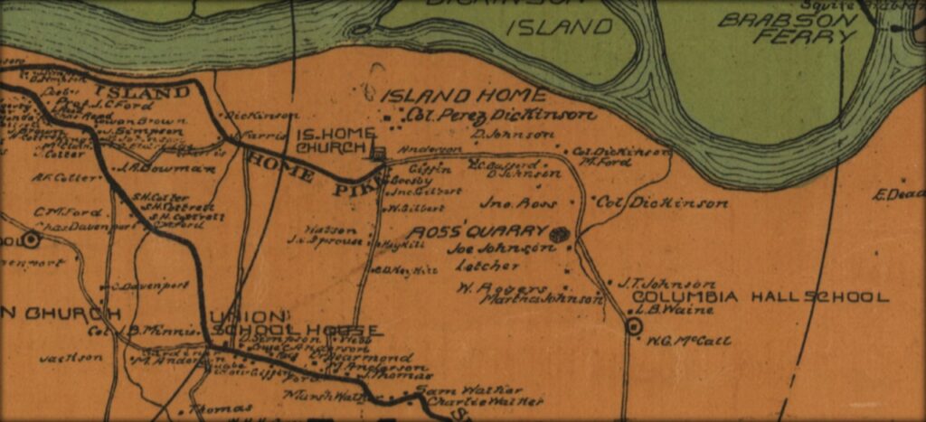
Map of Knox County, 1895 (detail). Note that several names featured on the map remain today in street names, including Gilbert, Cottrell, Minnis, and Giffin as in the old Giffin School. The Ross Quarry to the east is now part of Ijams Nature Center. (Library of Congress)
In the wake of Dickinson’s death in 1901, ownership of the land changed several times but the Island Home Park neighborhood that exists today traces its formation to 1911 and by the following year the South Knoxville streetcar line began to serve the growing community.
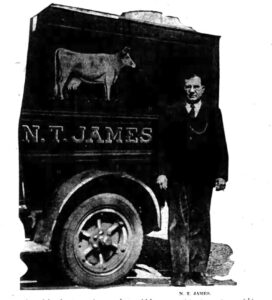 The same year as Dickinson’s death, N.T. James, a veteran of the Spanish-American War arrived in South Knoxville looking to acquire land. By 1905, he had settled in South Knoxville and established Island Home Dairy Farm with his wife, Mary Esther James. The farm started with six cows, and in time the farm is believed to have been the first dairy farm in Knoxville to deliver milk. Mary served as a Sunday School teacher at nearby Island Home Baptist Church.
By 1925, N.T. James, recognized as one of the city’s leading dairy farmers, added the Fresh Air Dairy Farm on Dry Gap Pike north of the city to his business holdings. From that point on, he managed the new farm while Mary oversaw the south Knoxville business.
When the city was attempting to establish a municipal airfield in 1928, five suitable properties were identified, including 115 acres of the Island Home Dairy Farm along McClung Avenue. Although an announcement was made citing the selection of the James’ property as the new airfield site, for unknown reasons the city ultimately chose an existing airfield along Sutherland Avenue in Bearden for its site to open McGhee Tyson Airport in 1929. A decade later, the airport moved to Blount County.
N.T. James died in 1944. Upon Mary’s death in 1959, a new city park was established on the dairy property at the intersection of South Haven Road and McClung Avenue.
The original farmhouse, now a residence, (and believed to have been built around 1892) still exists and is situated on South Haven Road just north of Mary James Park. The residence adjacent to it may have served as a milking shed. Current owners have found dairy tokens on the property. Other houses along South Haven near the park may have served as residences for employees of the diary.
In the early 20th century, the Holston Distillery was situated near the Island Home Dairy Farm, perhaps closer to where South Haven Road now meets Island Home Avenue. Old newspaper reports covered the sizeable seizure of whiskey around that spot in 1907. The raid was due to nonpayment of taxes by owner of the distillery, Robert H. Jones who subsequently went out of business and served jail time. The distillery may be connected with reports by residents living near Mary James Park of crushed glass and coal ash still evident on their properties.
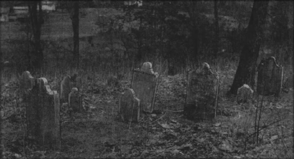
Baker-White Cemetery on Hackman Street (image circa 1940)
Cemeteries
While the city was surveying the Island Dairy Farm, the discovery of an old cemetery off Hackman Street raised interest. The cemetery is known as the Baker-White Cemetery. The oldest grave in the cemetery is thought to belong to Moses White (died 1830), son of founding father of the city, James White, and Moses’ wife Isabella (died 1842). The Baker in the cemetery’s name relates to Mary Baker (died 1846). At one time, remnants of Moses White’s cabin existed near this spot, although any remains appear to be long gone.
The Flenniken-Cunningham Cemetery is on the fringe of South Haven neighborhood off Hillcrest Drive, including at least one grave dating back to the late 1790s.
Growth of the Neighborhood
Although a few houses in South Haven are known to date back to the late 1800s, the community began to grow significantly with new housing developments following the annexation of South Knoxville within city limits in 1917. The sale of what was known to be the Watson Greenhouse business on South Haven Road (near the James property) provided space for 87 lots in 1924. By the mid-1940s, plans for up to 176 homes were in progress.
The neighborhood, officially known as the Crystal Springs Addition, was named after the natural spring that once existed on the Island Home Dairy Farm.
Several early street names were changed at some point to reflect names of popular UT Football players, including McEver, Dodd, Hickman, and possibly Gilbert (although Gilbert is also shown on old maps and is an old South Knoxville family name).
Giffin School
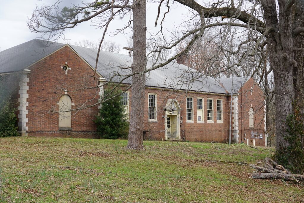
Like other communities around Knoxville, pinning down a date for the opening of the original Giffin School (originally listed in City Directories on Sevierville Pike, now Beech Street) is challenging. The first school was demolished in the 1920s but a new school, designed in the Colonial Rival style, on the same site opened on September 9, 1928 and lasted until 1995. Modifications are known to have been during the 1950s. The school later served as a location for Remote Area Medical for a time. Currently (as of March 2021) the building has undergone some initial redevelopments although plans to convert the structure into an upscale assisted living facility have stalled. Nevertheless, efforts to maintain the historical nature of the building have been conducted within the initial redevelopment phase.
Other Landmarks
Maynard Glenn Ballfields were created in 1985 and is named after long serving Director of City Parks and Recreation, Maynard Glenn, who died just after he retired the same year. The large playing field on McClung Avenue was the original field. Urban legends suggest that his connections enabled him to coordinate a helicopter to fly over and land to dry out the playing fields to enable play even in wet weather.
The Handy Dandy Food Market on South Haven Road has been a neighborhood staple since the 1980s. Before then it has hosted South Knox Television Sales and Service and an antiques store during the 1970s.
The Roundup Restaurant on the corner of Sevierville Pike and Lancaster Drive has been around for two decades. Across the street, the popular SoKno Taco restaurant is a 2016 redevelopment, which has included numerous businesses, most recently including Myrtle’s Mess.
A convenience store at the intersection of Fisher Place and Island Home Avenue (now converted to a residence) served the neighborhood until at least the 1930s, possibly much earlier. More research needs to be conducted to verify if this is the same location once used by the A.E. White Grocery Store that stood near here more than a century ago.
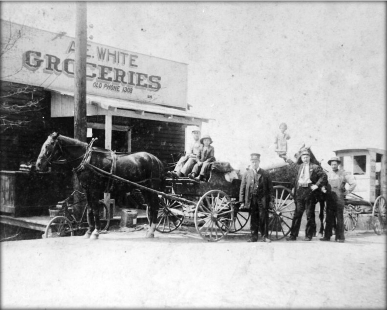
A.E. White Groceries, circa 1915. To the right is a truck belonging to the Island Home Dairy. (McClung Historical Collection)
Engage with Us
Research is ongoing. Help us learn more about the history of South Haven. If you have information or stories to share about the area, please contact Paul James with the Knoxville History Project or Gayle Atherton, representative for the South Haven Neighborhood Association.
The following recorded presentation by the Knoxville History Project, including a discussion with residents of the South Haven community, was conducted on March 22, 2021:
The Knoxville History Portal is funded in part by the Aslan Foundation.
