Sevier Avenue
Cross the Gay Street Bridge from downtown and turn left along Sevier Avenue and the south bank of the Tennessee River and you’ll find an often forgotten district that is enjoying an exciting period of economic development if not a full blown renaissance. For years, there were few restaurants or cafes in South Knoxville, particularly beyond Chapman Highway. The Roundup Restaurant on Sevierville Pike was practically the only exception. New breweries, coffee shops, restaurants, and outdoor retail outlets along Sevier Avenue have led to the areas hip new moniker, SoKno.
Join Jack Neely and Inside of Knoxville’s Alan Sims for a short conversation about the history of Sevier Avenue thanks to Knoxville Weekend:
http://www.knoxvilleweekend.com/knoxville-then-and-now-mcmurry/
Although hoped for by past City administrations, much of the change is due to the vision of the mountain bike community and Legacy Parks Foundation for creating the Knoxville’s Urban Wilderness. Add to that the growth of Ijams Nature Center, and Visit Knoxville and others’ championing of all things outdoors, are luring thousands more residents and visitors to venture into South Knoxville.
A key development in all this has been the addition of a new riverside park.

Jack Neely picks up the story about the park and some of the history surrounding the area off Sevier Avenue.
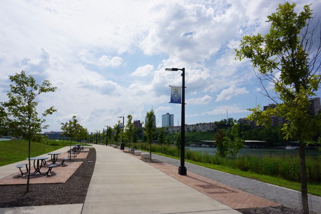
Suttree Landing Park looks nautical, with little pocket lookouts for picnics or contemplation almost like jetties. Stand at one of these promontories on a Saturday afternoon and you can hear beery-sounding laughter from half a mile away, across the river, from the marina or the apartments on the bluff.
It says something about Knoxville that we’re willing to celebrate a book that few Chambers of Commerce would countenance. A lesser city’s Chamber would review three paragraphs of Suttree and respond, “Well! I never!”
If Cormac McCarthy’s sometimes harrowing novel Suttree is not flattering in any conventional sense, with its descriptions of ratty scavengers, desperate sexual practices, revolting flotsam, awful whiskey, rabid bats, and suicide, with a subtle wash of typhoid, it’s perhaps the longest description of Knoxville ever published, and it accomplishes something that few Chambers of Commerce do. It makes the city sound pretty interesting.
I can’t speak for everybody, but journalists prefer cities that are interesting, and I think Suttree is fine. And Suttree Landing Park is interesting, itself. It’s approximately where the possibly fictional character Suttree, in an impulsive act of targeted civil disobedience, disposed of a stolen police car.
Maybe, if that car is no more fictional than most of Suttree is, it still abides in the opaque, inscrutable river. Divers assure me there are indeed cars down there.
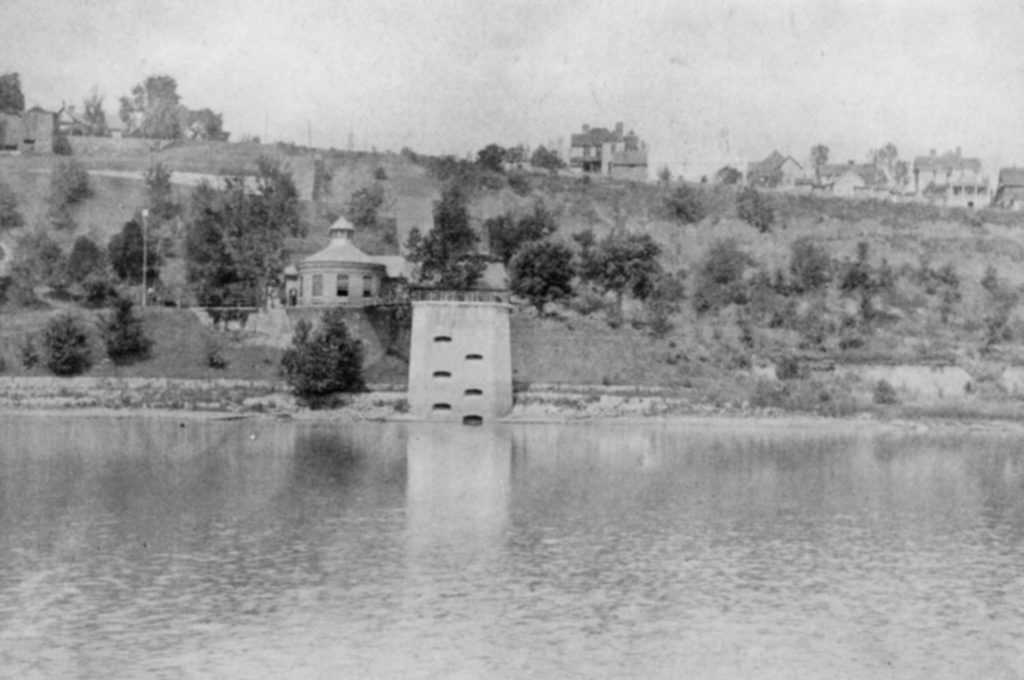
From here you can see, across the river, that one old round stone tower that has puzzled boaters for decades. It looks almost medieval, with apertures that suggest gun placements. It’s not surprising people have taken it for an ancient fort.

Water Intake at Knoxville Water Company on north side of the Tennessee River, circa 1890s.
In fact it’s the old intake tower for Knoxville’s ambitious water system. After a century of drinking whatever the river had handy, a private water company installed a state-of-the-art pumping and filtration system, modern for 1894. That Norman fort is all that remains of a much-larger network of water facilities. It’s more than twice as old as it needs to be to qualify for the National Register of Historic Places, but I’ve never heard that suggested.
The intake tower is much taller than what you see now, with the river at deep summer levels. Most of it is underwater. When the men were building that intake tower, perhaps they took a break with a wienerwurst sandwich, and looked over at this side. What they saw over here might have been a horse race.
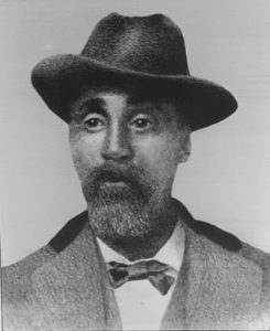
Today, even many who aren’t history scholars know that Cal Johnson, the astonishingly ambitious slave turned business tycoon, built a horse-racing track in East Knoxville, and that it’s now a residential cul-de-sac known as Speedway Circle. It’s less well known that before he opened that racetrack in 1897, he had another one, and it was on south bank of the river.

Cal Johnson. Courtesy of Beck Cultural Exchange Center.
I occasionally see references to “Johnson’s Racetrack” on the south side. I found some clues to its location from the late antiquarian Ron Allen, whose research indicated that it was between Sevier Avenue and the river, “east of the slaughterhouse.”
In his book Knox-Stalgia, Allen wrote that the racetrack first hosted events in 1881, when the site hosted a fair whose main attraction was horse racing. One such race was a setting for the escalating disagreement that led to the triply fatal Mabry-O’Conner gunfight on Gay Street the following day.
According to Allen, Johnson didn’t build this racetrack, but acquired it sometime during its first decade. An owner of racehorses, and a sometime jockey himself, Johnson had a natural interest. Johnson’s Racetrack welcomed horse races, footraces, and bicycle races. In 1894, it hosted the opening of the horse-racing season, but also bicycle races sponsored by the Knoxville Racing Wheelmen. Some races drew as many as 2,000 spectators.
Johnson made his racetrack available to everybody, and for a few years it was central to entertainments attracting the white majority. Champion athlete and future war hero U.S. Brig. Gen. Cary Spence won a footrace there in 1891. But the riverside amenity seems to have been especially valued by the black community. A group of “colored bicyclists” known as the Marble City Wheelmen had meets there. An Emancipation Day festival was held at Johnson’s Racetrack on Aug. 8, 1895.
It stayed lively, at least occasionally, for some years after Johnson opened his better-remembered new track in East Knoxville in 1897. The university, which lacked its own track, was still using the South Side Track for track meets as late as 1917.
Allen refers vaguely to finding the racetrack on an 1895 map. I assumed he referred to the giant, intricately detailed 1895 map of Knox County that’s framed on the wall at the McClung Collection. The slaughterhouse is noted thereon, but not a racetrack. However, with the help of librarians at McClung, I found the map Allen referred to, a city map that happens to include some suburban areas, as this was then.
On the south side of the river, right there, is a long, neat oval, and very clearly noted, RACE TRACK. It looks like a precise half-mile circuit. Everything else has changed, but the water intake is indicated on the map, directly across the river.


